
April campaign 2016
In the spring of 2016, a team of archaeologists (S. Müth-Frederiksen, K. Winther-Jacobsen, G. Giannakopoulos, Z. Spyranti) and geoscientists conducted manual augerings (W. de Neef, N. Noorda) combined with a resistivity survey (B. Ullrich) for a quick-scan of soil properties and sediment thicknesses in the plain between the rivers Asopos and Helisson. The main aim of this research was to reconstruct landscape formation processes, such as soil erosion and accumulation, in this area. The gentle slopes of this plain are not continuous, but consist of a series of gradual steps known as marine terraces. These terraces were originally formed as shallow-water deposits in a river delta, and were uplifted by different tectonic movements. The result is a complex landscape of different soils, affected by erosion along the terrace slopes, soil accumulation at the terrace bases, and sediment transport through the rivers Asopos and Helison.
.")
.")
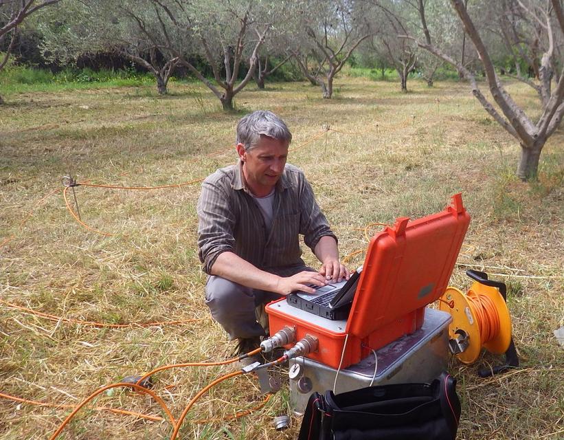
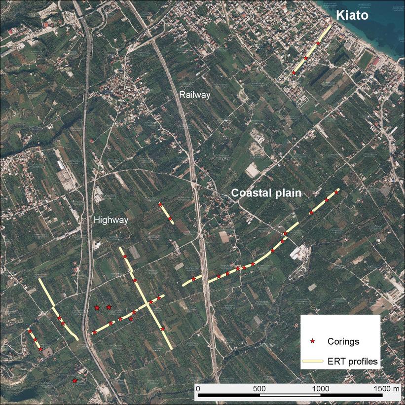
The augerings (using an Edelman screw auger, see Figs. 1-2) were conducted along the same transects as the electrical resistivity measurements, as well as in locations where major anomalies had been mapped by previous geophysical investigation (Figs. 2-4). The preliminary results show different soil types and sediment thicknesses along the investigated transects (Fig. 5). Archaeological stratigraphies to depths of more than 3 m were mapped on the upper terrace, including pottery related to the settlement phase of Sikyon. Moreover, indications were found of an ancient lake associated with prehistoric artefacts. At the centre of the research area, however, very shallow, strongly eroded soils without traces of human activity were mapped. The lower terraces, nearest to Kiato, again yielded deeper soils with indications of human presence.
Furthermore, a first attempt at locating the ancient harbour of Sikyon was made. Three augerings along a transect towards the modern coastline yielded indications of a small, shallow marine inlet. While the two outer cores ended on hard conglomerate deposits within 150 cm depth, the centre one showed fine marine sediments with pebble layers such as can be expected in coastal situations, at 280 cm depth. Further work is needed to confirm the presence of a natural bay or man-made harbour, but the results of this campaign are encouraging.
.")